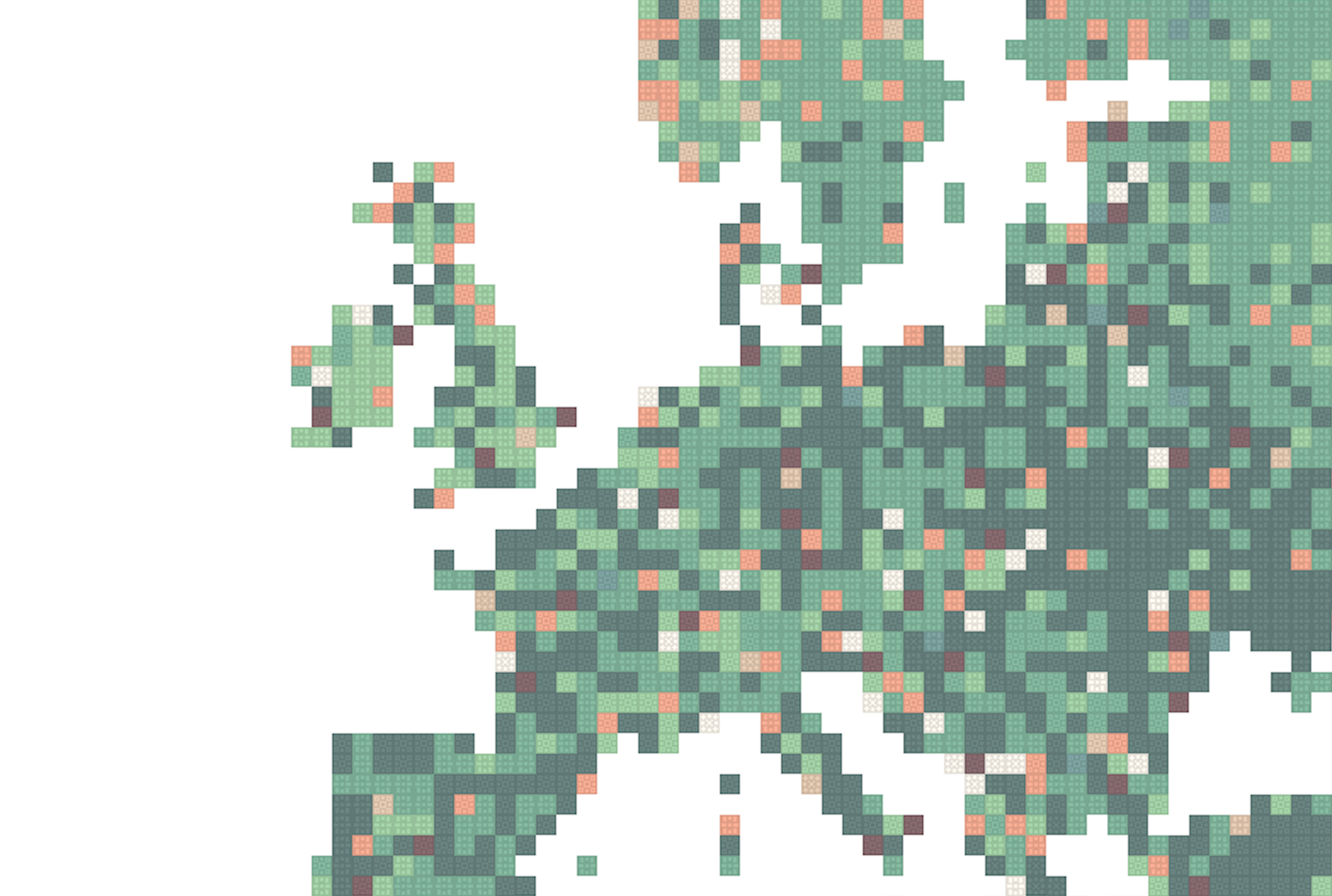
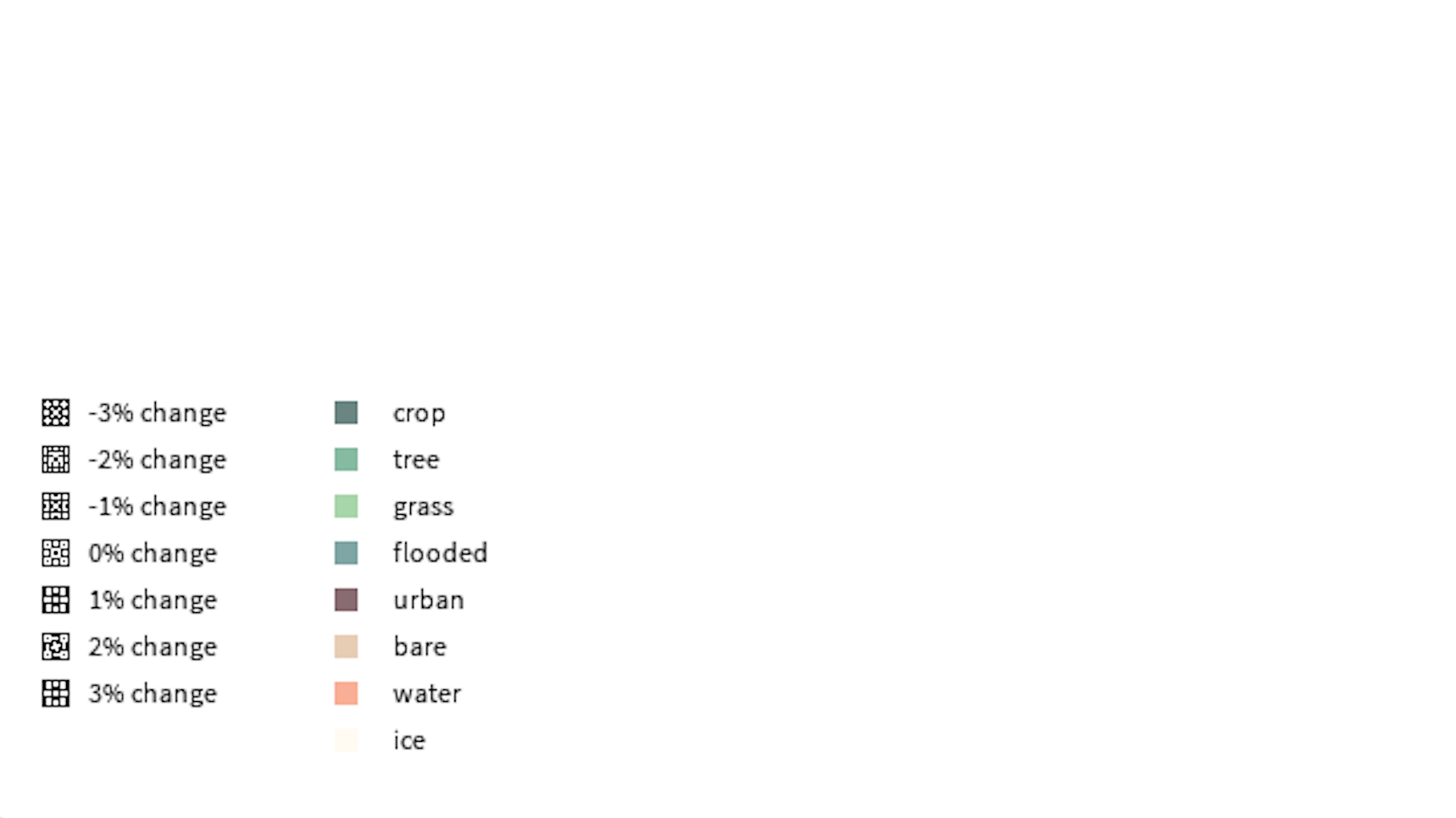
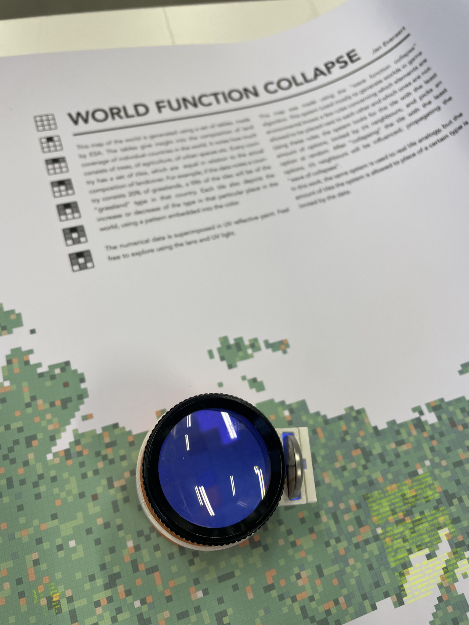
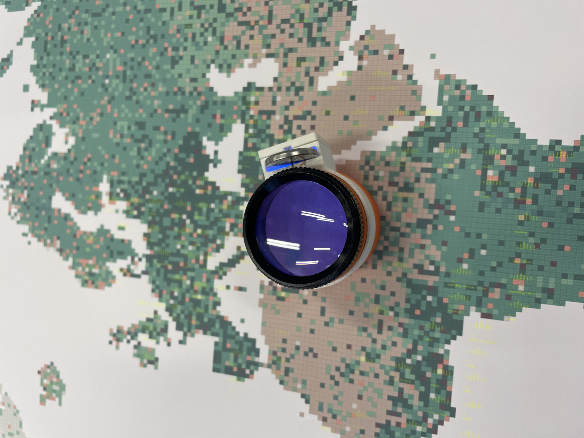
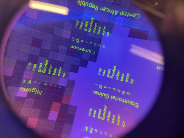
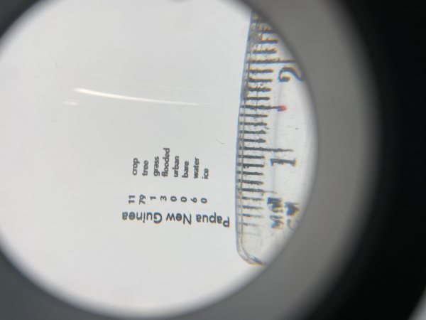
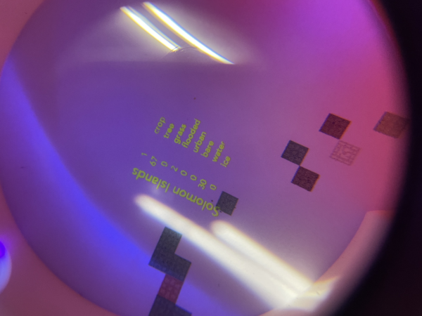
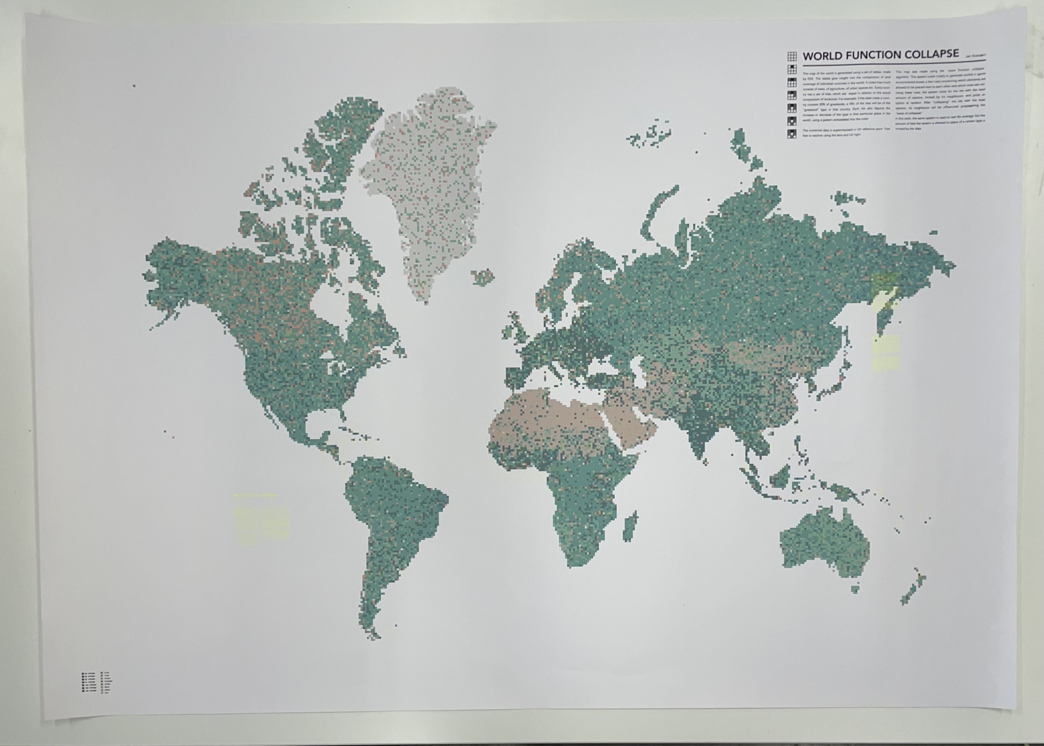
World function collapse
Generated map of land cover composition growth —
Scope
A map (1020mmx720mm) of the world, displaying the relative land cover composition. Explorable with a magnifying glass, UV reflective ink is used to display the human readable data per country at a comparable location.